MAAP #19: Gold Mining Deforestation Advancing along Upper Malinowski River (Madre de Dios, Peru)


In MAAP #5, we described the intensifying deforestation along the Upper Malinowski River in the department of Madre de Dios, Peru. Here in MAAP #19, we update this information and confirm that the deforestation continues at a rapid pace. This finding is based on analysis of three high-resolution images between September 2014 and November 2015. As described below, we document the deforestation of 392 hectares (969 acres) between September 2014 and November 2015 due to gold mining along the Upper Malinowki River.
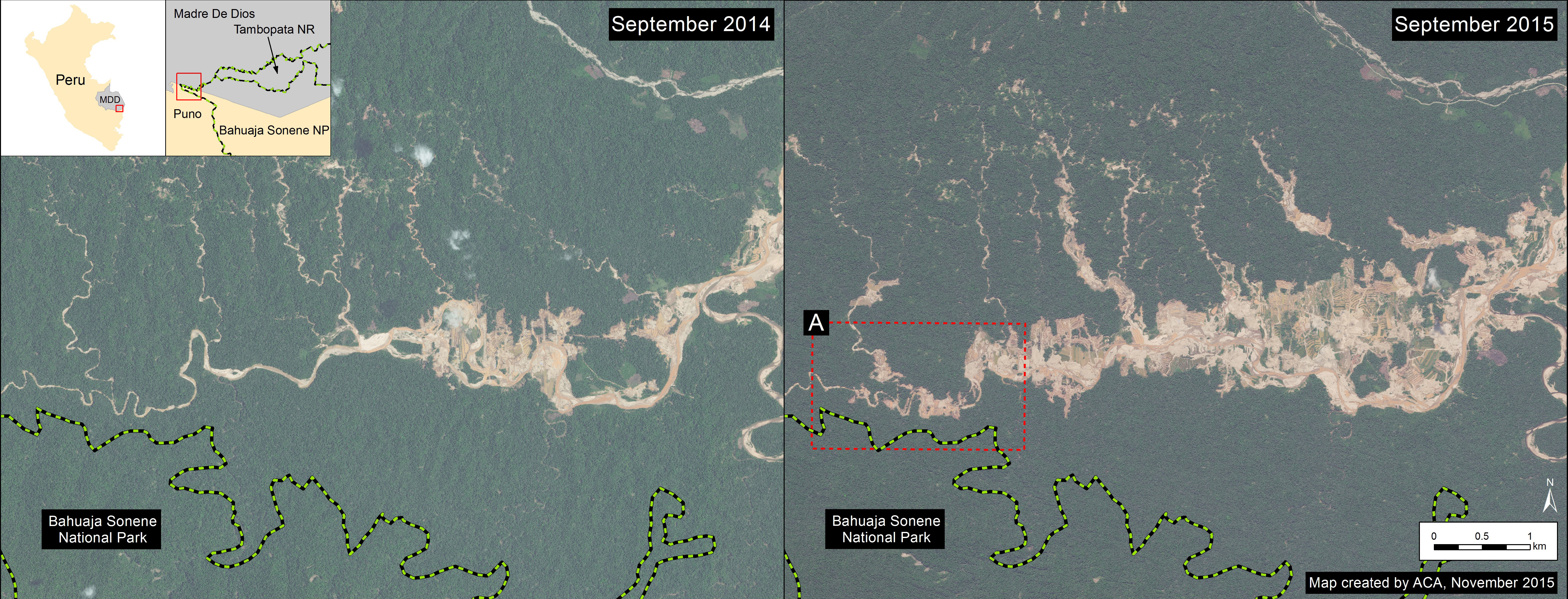
Image 19a. Gold mining deforestation between September 2014 and 2015 along Upper Malinowski. Data: SERNANP, WorldView-2 from Digital Globe (NextView).
Image 19a shows a comparison of two high resolution (0.5 m) images taken one year apart over the same area along the Upper Malinowski River (left panel is from September 2014, while the right panel is from September 2015). Comparison analysis of these images reveals two primary findings. First, deforestation is rapidly spreading upstream along the Upper Malinowski and its tributaries.
Second, this deforestation is nearing the border of the Bahuaja Sonene National Park boundary (see Image 19b).
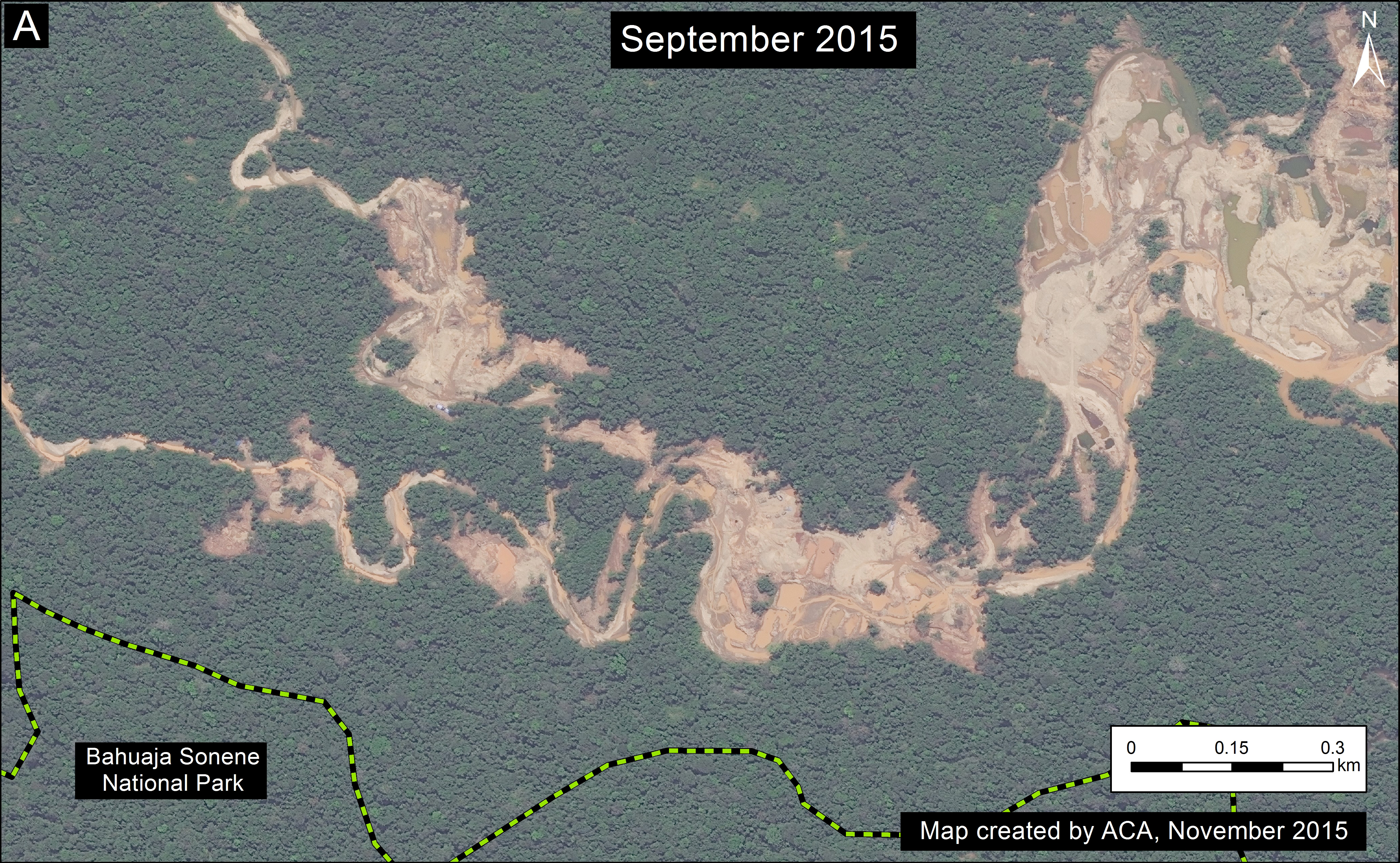
Image 19b. Zoom of gold mining deforestation near the Bahuaja Sonene National Park. Data: SERNANP, WorldView-2 from Digital Globe (NextView).
Deforestation Analysis
Image 19c is a detailed deforestation analysis between the two images. We documented the deforestation of 352 hectares (870 acres) due to gold mining activities between September 2014 and September 2015 along the Upper Malinowski (note: this calculation covers the area displayed in Image 19a).
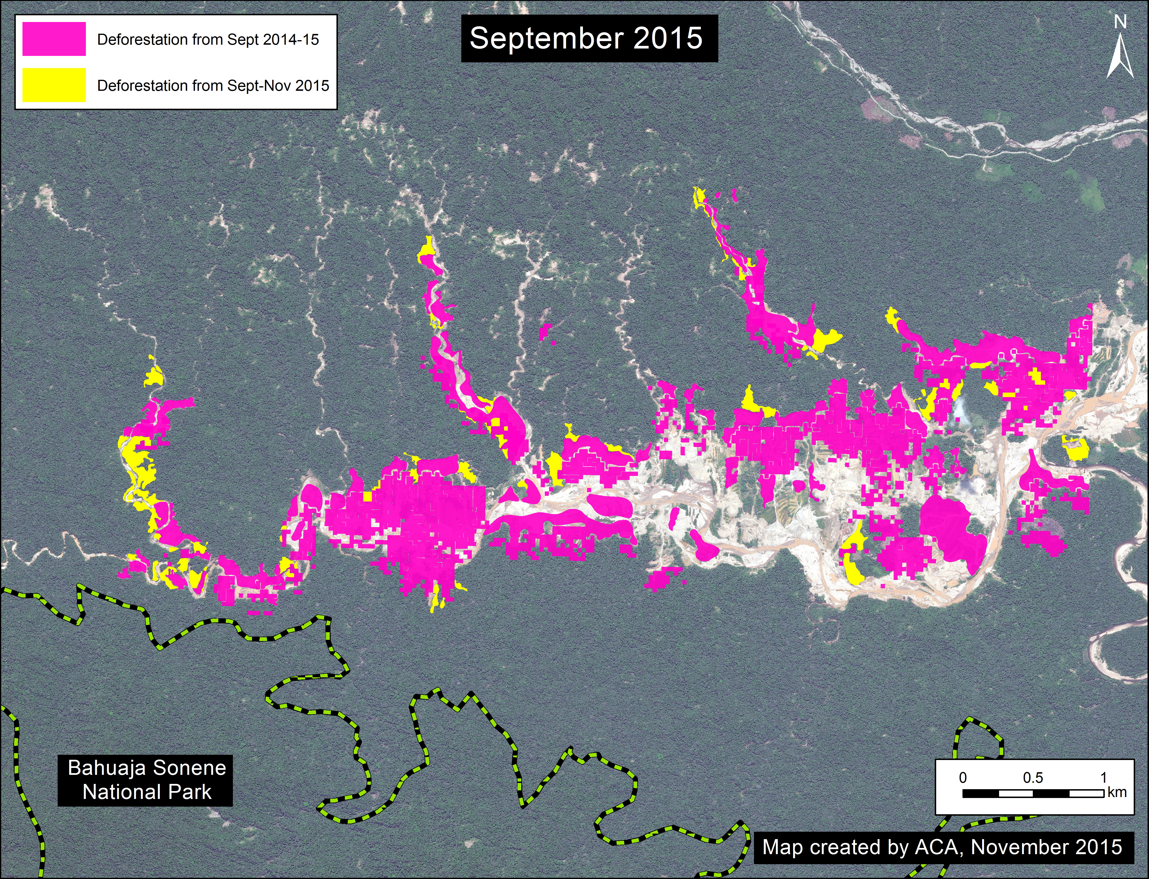
Image 19c. Deforestation analysis between September and November 2015 along the Upper Malinowski. Data: CLASlite, SERNANP, WorldView-2 from Digital Globe (NextView).
During preparation of this article, a new high resolution image over the same area from November 2015 became available. As an indication of how rapidly the gold mining is advancing, we documented an additional deforestation of 40 hectares (99 acres) between September and November 2015.
Thus, we documented a total deforestation of 392 hectares (969 acres) between September 2014 and November 2015 along the Upper Malinowki.
Two Gold Mining Deforestation Fronts
The Upper Malinowki is just west (and upstream) of the mining zone known as La Pampa featured in MAAP articles #1, #12, and #17. These currently appear to be the two major gold mining deforestation fronts in Madre de Dios. Image 19b illustrates the general location of these two areas (“C” indicates La Pampa and “D” indicates the Upper Malinowski). Note that La Pampa is within the buffer zone of the Tambopata National Reserve and the Upper Malinowski is within the buffer zone of the Bahuaja Sonene National Park.
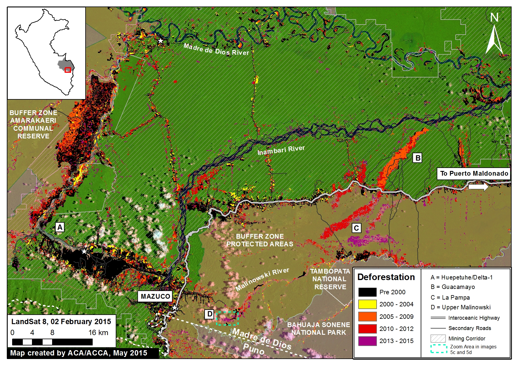
Imagen 19d. General location of the Alto Malinowski (“D”) and La Pampa (“C”). Data: CLASlite, MINAM, SERNANP, ACCA, Hansen/UMD/Google/USGS/NASA, USGS.
Citation
Finer M, Snelgrove C (2015) Gold Mining Deforestation Rapidly Advancing along Upper Malinowski River (Madre de Dios, Peru). MAAP: 19.
Download PDF of this article