MAAP #54: Natural forest loss due to “hurricane winds” in the Peruvian Amazon


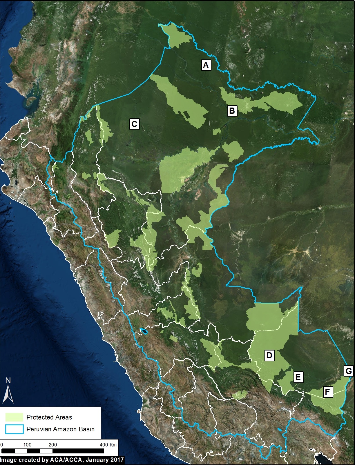
Image 54. Base Map
A little-known, but not uncommon, type of natural forest loss in the Peruvian Amazon is blowdown due to strong winds from localized storms (locally known as “hurricane winds”).
The intense winds cause a chain reaction of fallen trees, resulting in a fan-shaped pattern of forest loss with a defined orientation following the direction of the storm winds.
This phenomenon has previously been reported in Brazil and Colombia (see References below).
The base image (Image 54) shows the location of some recent (during 2016) examples of forest loss due to blowdowns in the Peruvian Amazon.
These examples were initially detected from analysis of GLAD alerts, early warning tree loss data produced by the University of Maryland (see Annex).
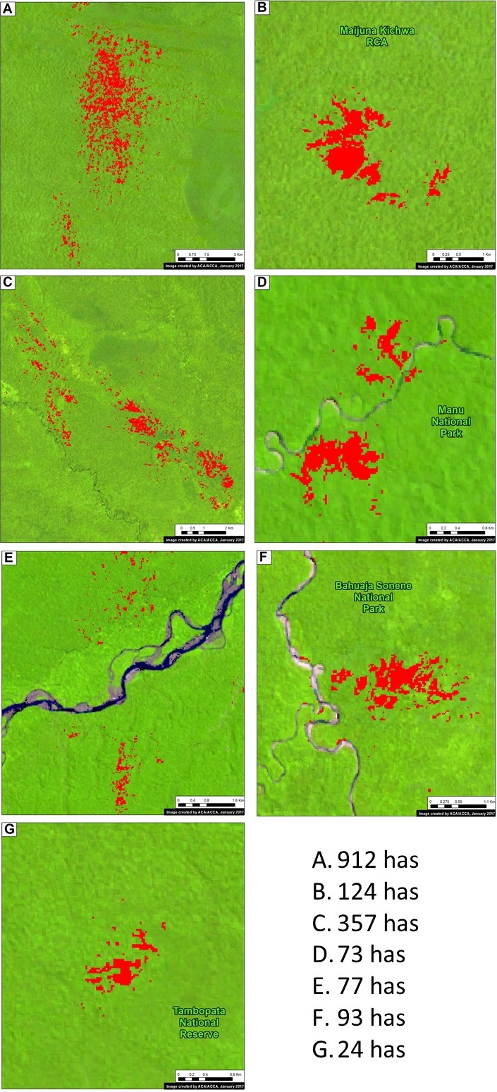
Below, we detail the 7 blowdown examples indicated on the base map. They are located in both northern (Loreto region) and southern (Madre de Dios region) Peru, and include 4 Protected Areas. The forest loss in these examples ranged from 24 to 900 hectares.
Loreto Examples
This section highlights 3 examples of blowdowns in Loreto. In each example, we show an image of before (left panel) and after (right panel) the forest loss due to the winds. The documented forest loss in these areas includes: 912 hectares in Example A, 124 hectares in Example B (Ampiyacu Apayacu Regional Conservation Area), and 357 hectares in Example C.
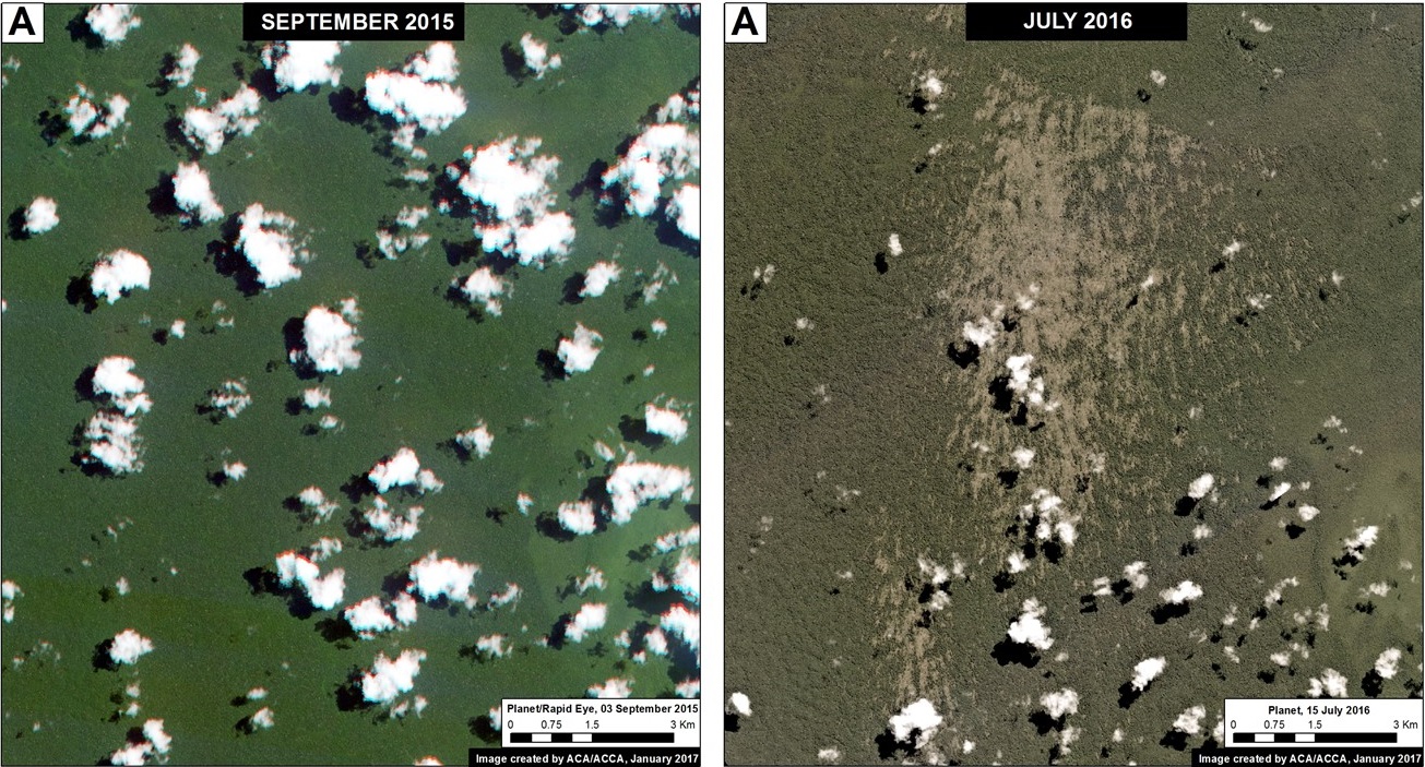
Image 54a. Data: Planet.
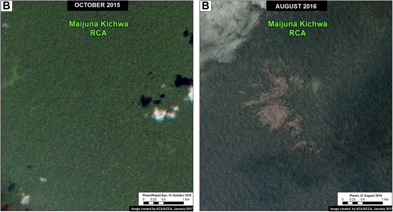
Image 54b. Data: Planet. Note: Blowdown in Ampiyacu Apayacu RCA, not Maijuna.
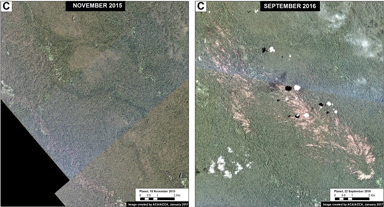
Image 54c. Data: Planet.
Madre de Dios Examples
This section highlights 4 examples of blowdowns in Madre de Dios. In each example, we show an image of before (left panel) and after (right panel) the forest loss due to the winds. The documented forest loss in these areas includes: 73 hectares in Example D (Manu National Park), 77 hectares in Example E, 93 hectares in Example F (Bahuaja Sonene National Park), and 24 hectares in Example G (Tambopata National Reserve).
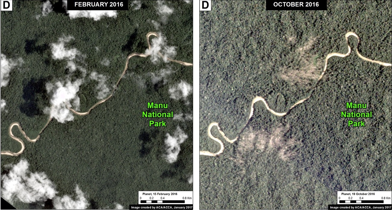
Image 54d. Data: Planet.
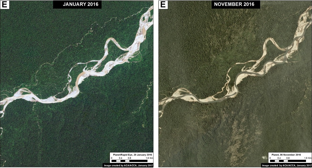
Image 54e. Data: Planet.
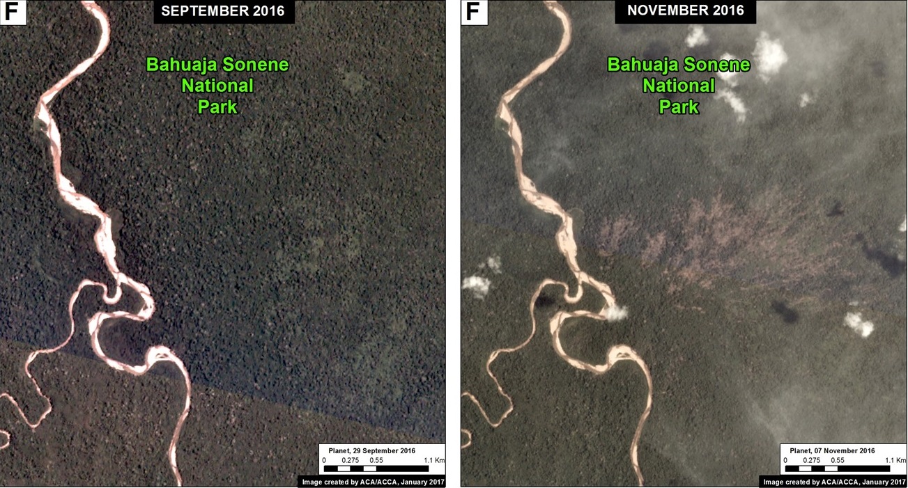
Image 54f. Data: Planet.
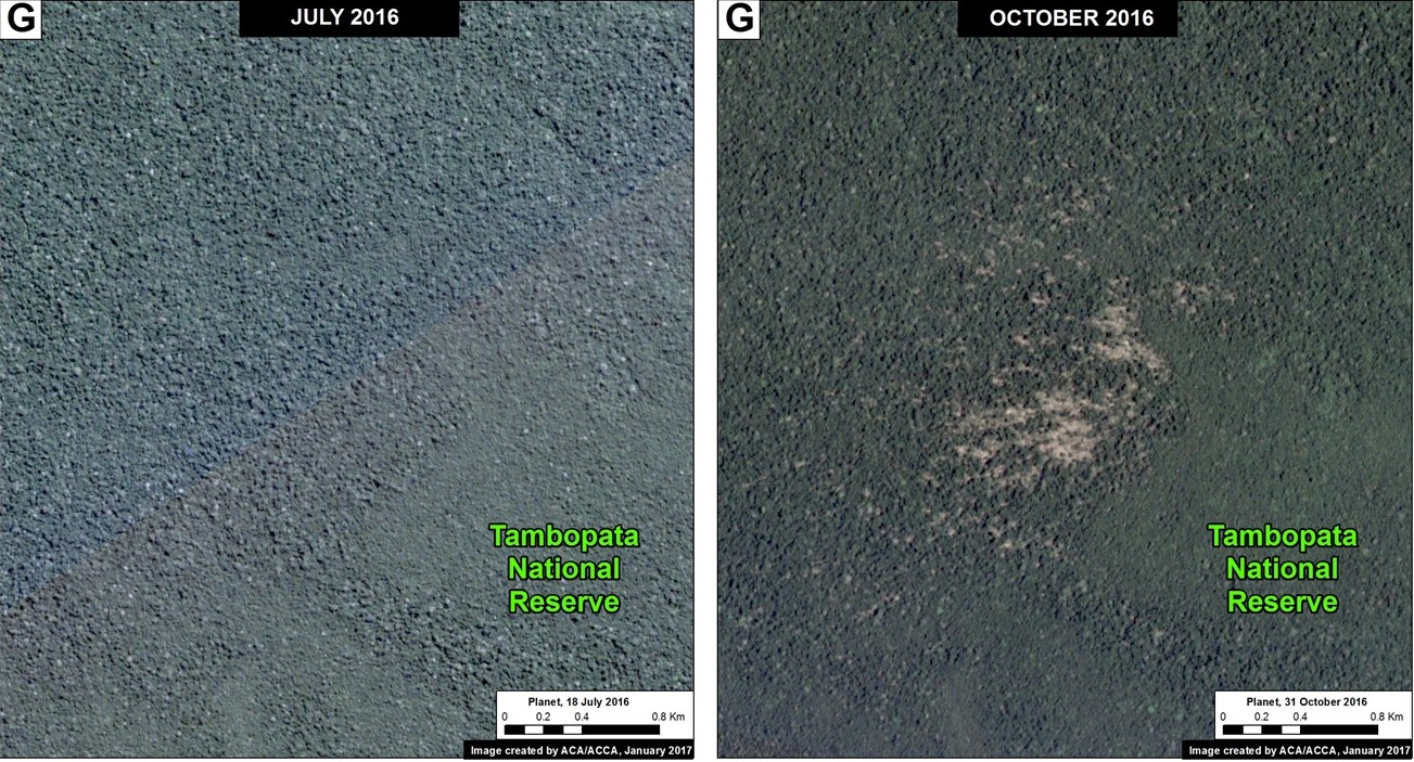
Image 54g. Data: Planet.
Annex
This last image shows how the tree loss patterns from blowdowns appear in the GLAD alerts.
Coordinates
A. -1.386944, -73.679444
B. -3.029722, -72.786666
C. -3.456111, -76.713333
F. -13.294722, -69.295833
References
Espırito-Santo, F. D. B. et al. Storm intensity and old-growth forest disturbances in the Amazon region. Geophys. Res. Lett. 37, L11403 (2010).
Nelson, B. W. et al. Forest disturbance by large blowdowns in the Brazilian Amazon. Ecology 75, 853–858 (1994).
Garstang, M., White, S., Shugart, H. H. & Halverson, J. Convective cloud downdrafts as the cause of large blowdowns in the Amazon rainforest. Meteorol. Atmos. Phys. 67, 199–212 (1998).
Etter y Botero (1990) Efectos de los procesos climáticos y geomorfológicos en la dinámica del Bosque Húmedo Tropical de la Amazonía Colombiana. Colombia Amazonica 4:7.
Citation
Novoa S, Finer M (2017) Natural forest loss due to “hurricane winds” in the Peruvian Amazon. MAAP: 54.
Download PDF of this article