MAAP #55: New 2017 “Hurricane Winds” in Peruvian Amazon


In the previous MAAP #54, we described the phenomenon of natural forest loss due to “hurricane winds,” showing several examples from 2016 in the Peruvian Amazon. Strong winds from these localized storms can knock down hundreds of acres of forest at a time.
In January 2017, GLAD tree loss alerts indicated two new hurricane wind events in the southern Peruvian Amazon (Madre de Dios region). Below, we show high-resolution images of these cases. The first is a large hurricane wind event that knocked down 780 acres (Image 55a). The second is an event of 185 acres that took place within a forestry concession (Image 55b).
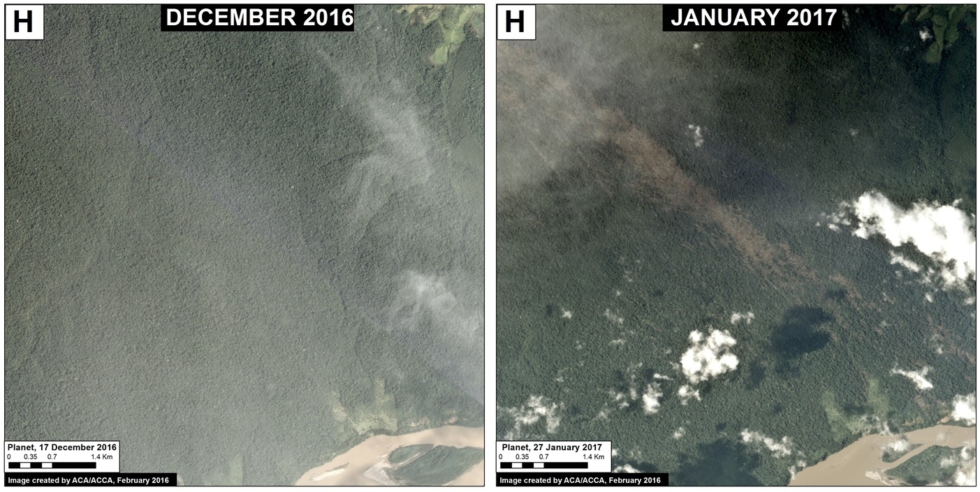
Image 55a: Data: Planet
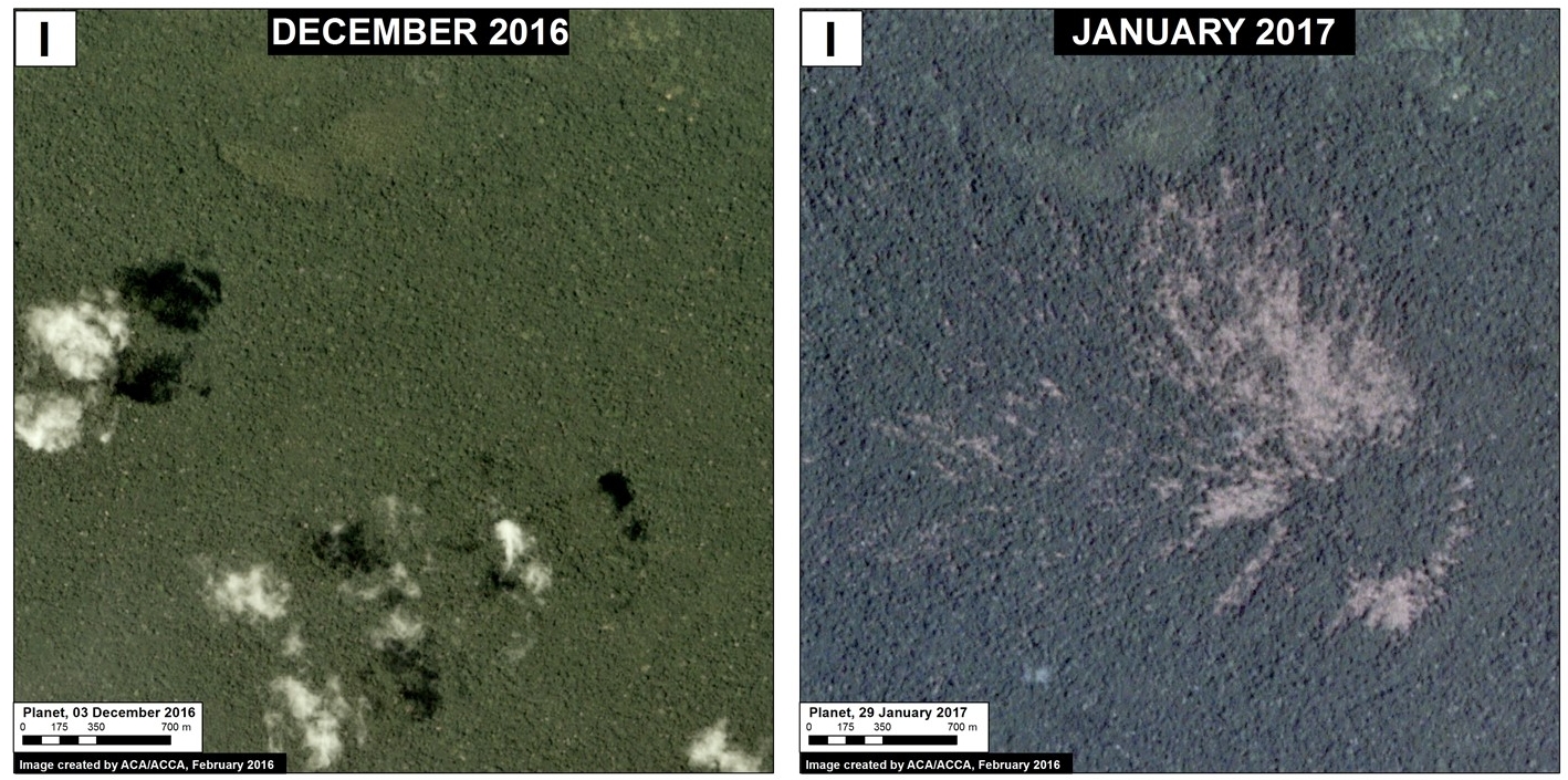
Image 55b: Data: Planet
Very High Resolution View
We also show a new very high resolution image (0.5 meters) of one of the hurricane wind events in 2016 in the Loreto region (example B of MAAP #54). Image 55c shows the following pattern: fan-shaped pattern of forest loss with a defined orientation following the direction of the storm winds. It is worth mentioning that this event occurred within a protected area, Maijuna-Kichwa Regional Conservation Area.

Image 55c. Data: Digital Globe (Nextview)
Reference
Citation
Finer M, Novoa S (2017) New 2017 “Hurricane Winds” in Peruvian Amazon. MAAP: 55.
Download PDF of this article