MAAP #76: Proposed Road would cross Primary Forest along Peru-Brazil Border

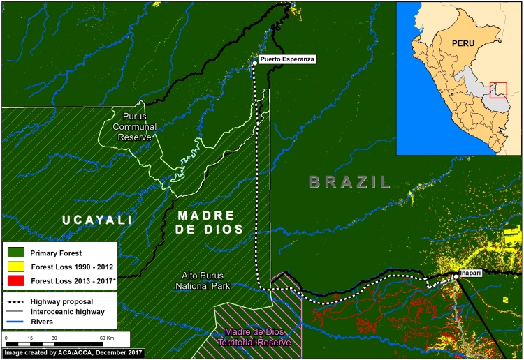
In December 2017, the Peruvian Congress approved a bill that declared it in the national interest to construct new roads in the border zone of Ucayali region, which shares a remote border with Brazil.
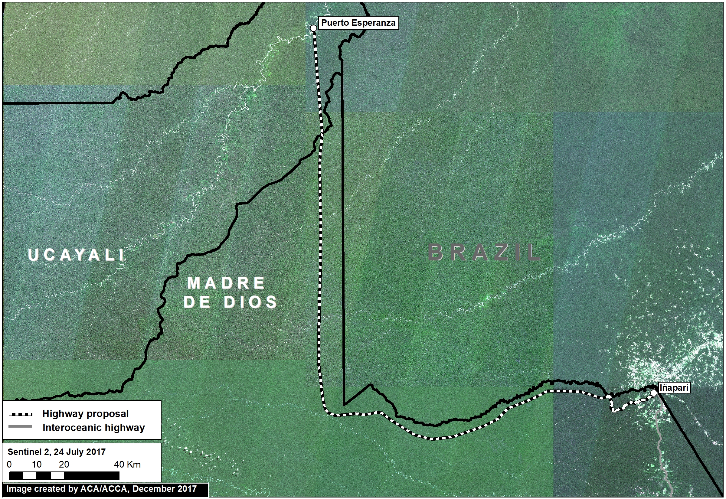
The main proposed road in this border area would cover 172 miles and connect the towns of Puerto Esperanza and Iñapari, in the Ucayali and Madre de Dios regions, respectively. Image 76a, a mosaic of satellite images from July 2017, illustrates just how remote and intact is the area surrounding the proposed road route.
Indigenous organizations and the Ministry of Culture have warned that the road would have major impacts on the indigenous peoples in voluntary isolation that are documented to inhabit parts of this remote area.
In this report, we add new information that complements the evaluation of possible impacts by calculating how much primary forest would be threatened as a result of road construction. We found that around 680,000 acres (275,00 hectares) of primary forest are at risk. Much of this area is within protected areas and a reserve for isolated indigenous groups.
Primary Forest

Image 76b. Data: GLCF/GSFC 2014, Hansen/UMD/Google/USGS/NASA, UMD/GLAD, PNCB/MINAM, UAC/ProPurús, SERNANP
We generated a primary forest layer based on existing satellite-based forest cover and forest loss data (see Methodology section for more details). We define primary forest as areas with intact forest cover dating back to the earliest available satellite-based data, 1990 in this case.
Image 76b shows the major results:
- Virtually the entire route (172 miles; 277 km) crosses primary forest (dark green). Note the proliferation of forest roads in recent years around Iñapari (red lines).
- The road would cross 3 critical protected areas and indigenous reserves: Madre de Dios Territorial Reserve, Alto Purús National Park, and Purús Communal Reserve.
Primary Forest at Risk
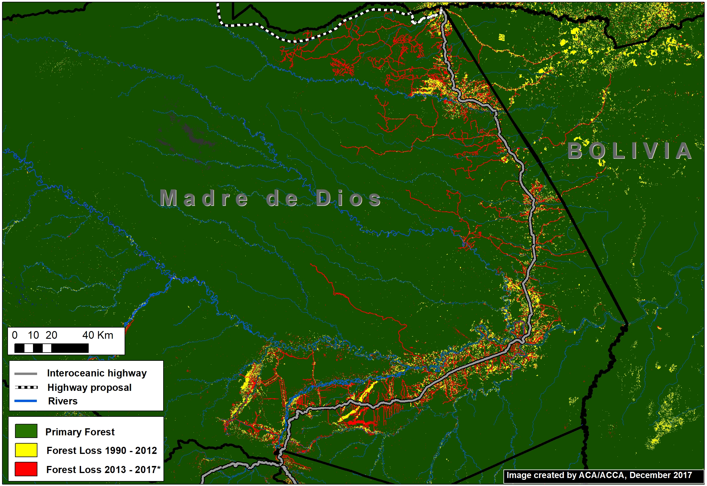
The Interoceanic Highway, the main existing road in the area, has experienced substantial deforestation within 5 km* along the length of its route (Image 76c).
Using this estimate of impact range (10 km), we calculated that at least 274,727 hectares of primary forest would be at risk if this road is constructed.
*We estimate that approximately 80% of forest loss has occurred in a 5 km radius on both sides of the Interoceanic highway.
Methodology
To generate our primary forest layer, we combined three satellite-based data sources. As baseline, we used data from the Global Land Cover Facility (2014), which identifies forest cover as of 1990. We also used this dataset to remove areas with detected forest cover change between 1990 and 2000. Next, we removed areas with detected forest loss between 2001 – 2017 identified by Hansen/UMD/Google/USGS/NASA (Hansen et al 2013) and early warning data from GLAD alerts and the National Program of Forest Conservation of the Peruvian Environment Ministry (PNBC-MINAM). As a result, combining all datasets, this methodology defines primary forest as area with intact forest from the first available satellite-based data, 1990, until 2017.
Global Land Cover Facility (GLCF) and Goddard Space Flight Center (GSFC). 2014. GLCF Forest Cover Change 2000, 2005, Global Land Cover Facility,University of Maryland, College Park.
Hansen MC et al. 2013. High-Resolution Global Maps of 21st-Century Forest Cover Change. Science 342: 850–53.
Citation
Finer M, Novoa S (2018) Proposed Road would cross Primary Forest along Peru-Brazil Border. MAAP: 76.
Download PDF of this article


