MAAP #131: Power of Free High-resolution Satellite Imagery from Norway Agreement


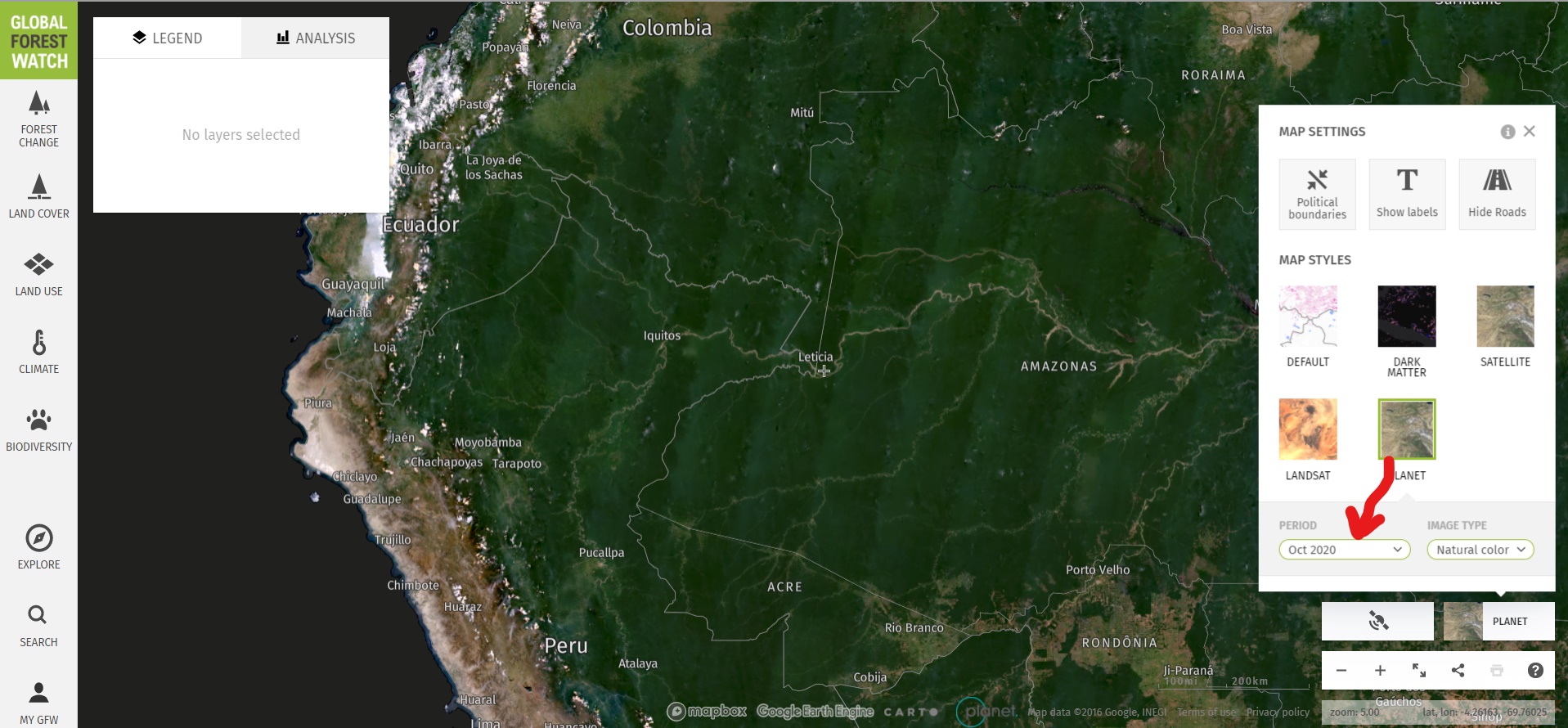
Image 1. Monthly Planet basemap for October 2020 across the Amazon, as seen on Global Forest Watch.
This report demonstrates the powerful application of freely available, high-resolution satellite imagery recently made possible thanks to an agreement between the Government of Norway and several satellite companies.*
This unprecedented agreement will bring commercial satellite technology, previously out of reach to many, to all working in tropical forest conservation around the world.
Here we show how MAAP (an initiative of Amazon Conservation) will use this information to enhance our real-time monitoring program and quickly share timely findings to partners in the field.
Specifically, we highlight the importance of the monthly basemaps (4.7-meter Planet imagery) available under the Norway agreement.* For example, Image 1 shows the stunning, nearly cloud-free October 2020 basemap across the Amazon.
Colombian Amazon
First, we detected recent forest loss alerts (known as GLAD alerts), in the northwestern sector of Chiribiquete National Park. Image 2 is a screen shot of our monitoring search in Global Forest Watch (link here).
Second, we investigated the alerts with the freely available monthly Planet basemaps. Images 3-5 show the basemaps from October to December 2020. These images confirm that the area was covered in intact (likely primary) Amazon rainforest in October, and then experienced a major deforestation event (225 hectares) in November and December. Similar deforestation in the area appears to be conversion to cattle pasture. Note the crosshairs (+) represent the same point in all four images.
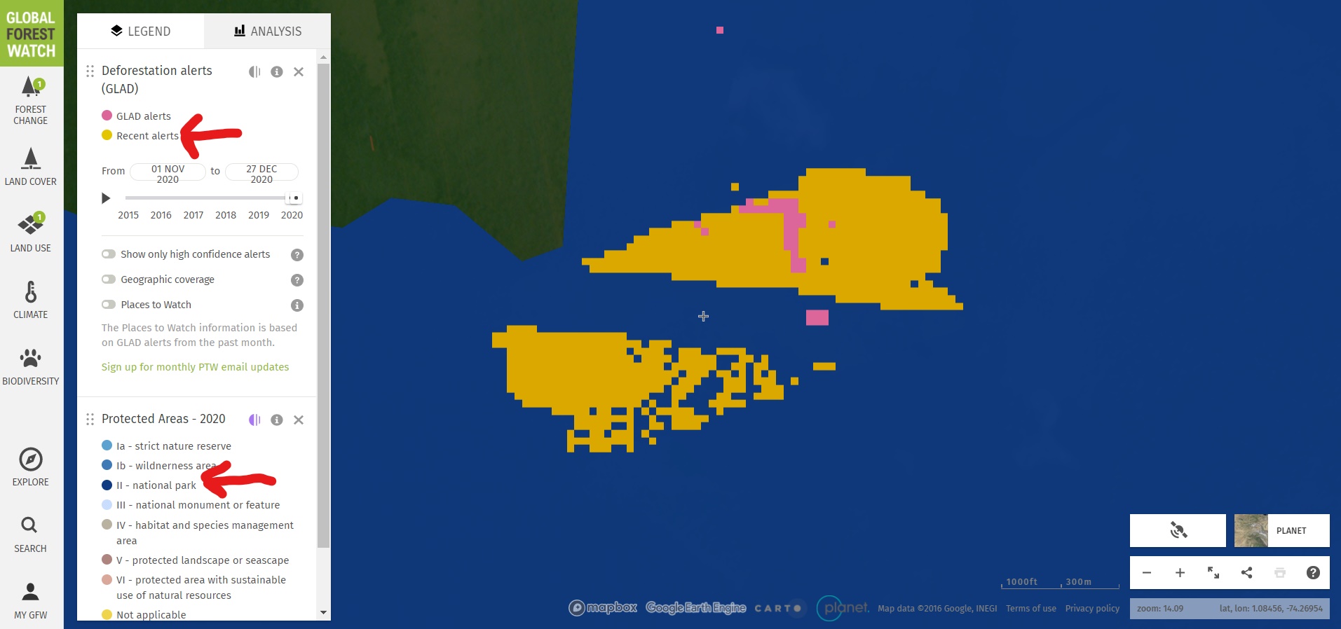
Image 2. Forest loss alerts in Chiribiquete National Park
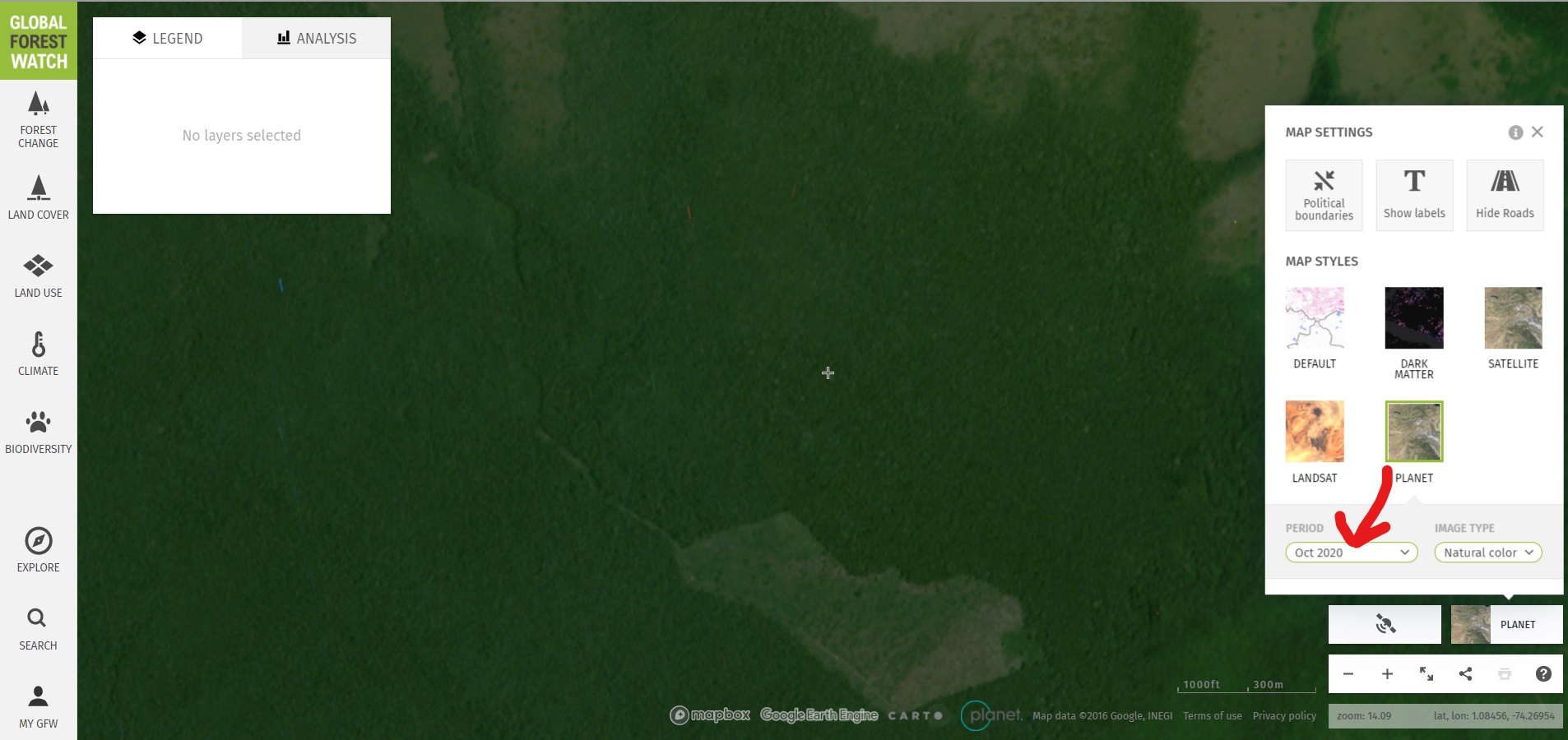
Image 3. Monthly Planet basemap for October 2020 in Chiribiquete National Park.
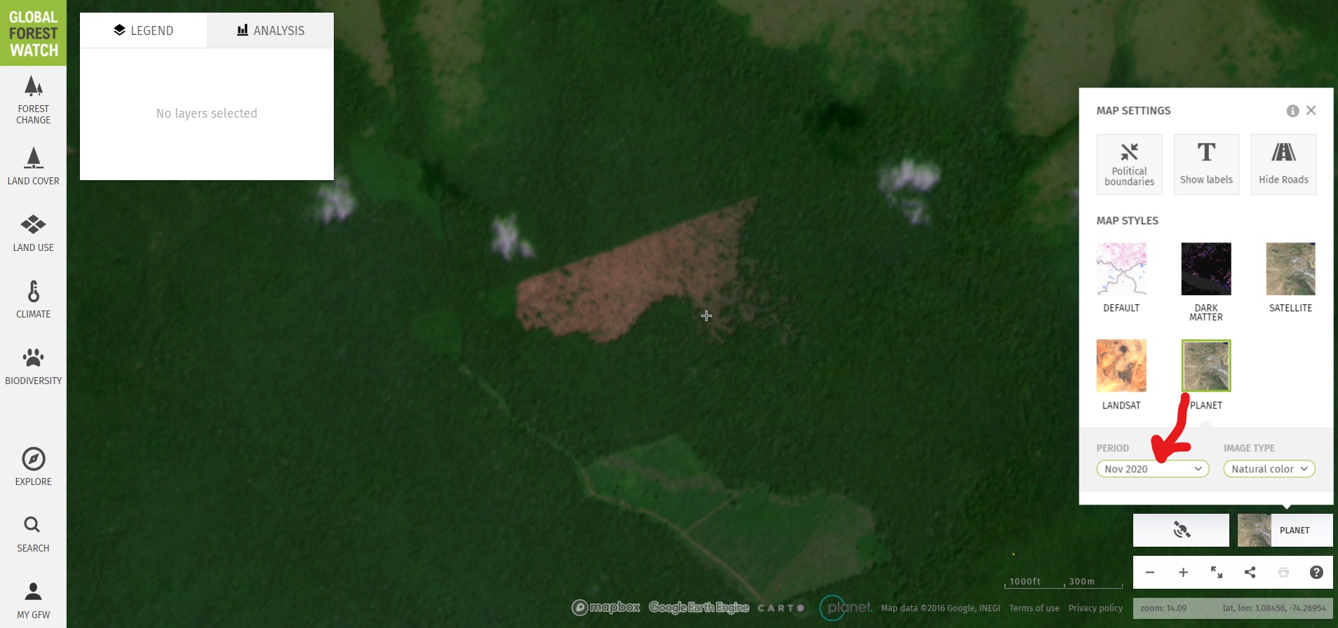
Image 4. Monthly Planet basemap for November 2020 in Chiribiquete National Park.
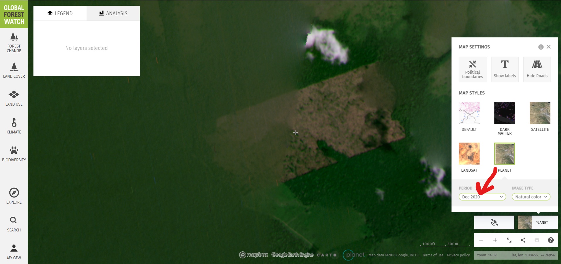
Image 5. Monthly Planet basemap for December 2020 in Chiribiquete National Park.
Peruvian Amazon
Similarly, we detected recent forest loss alerts in an illegal gold mining area in the southern Peruvian Amazon known as Pariamanu (Image 6). Images 7 & 8 show the monthly basemaps confirming the expansion of illegal mining deforestation between October and December (see yellow arrows). Global Forest Watch link here.
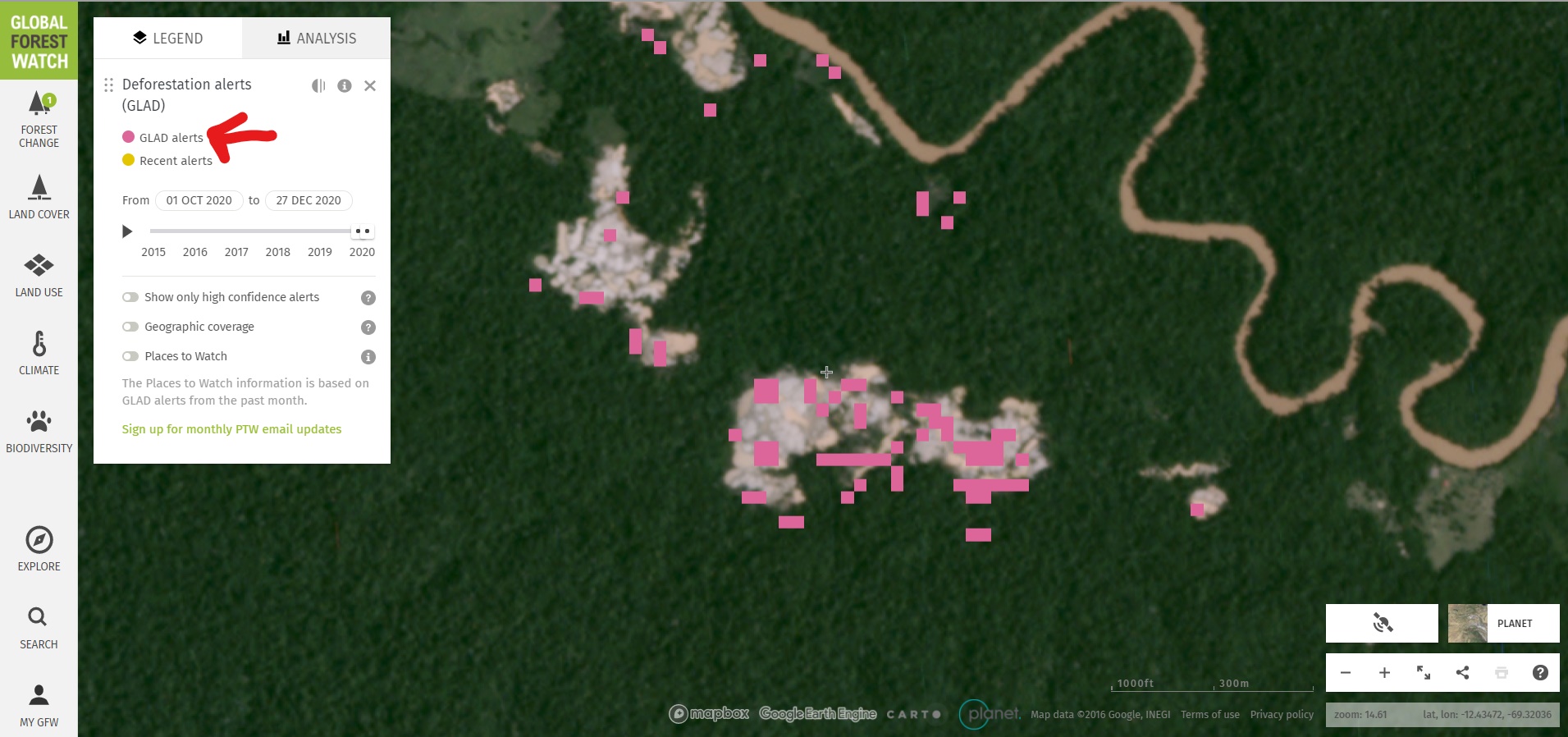
Image 6. Forest loss alerts in illegal gold mining zone (Pariamanu).
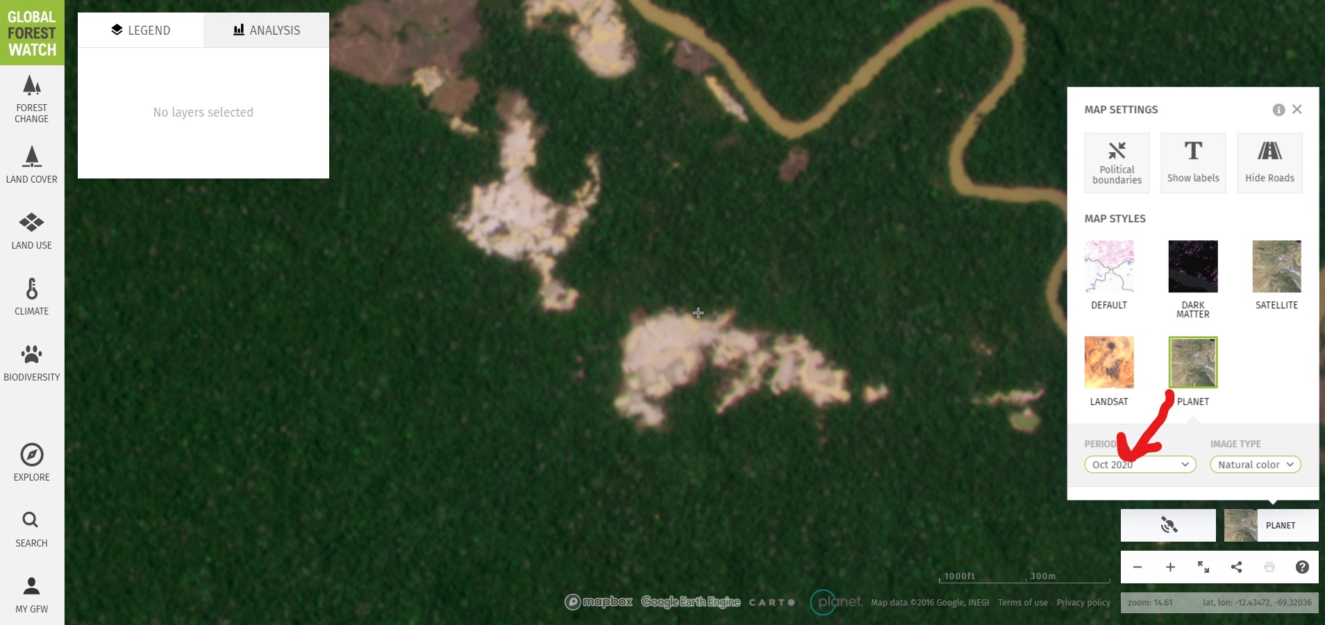
Image 7. Monthly Planet basemap for October 2020 in Pariamanu.
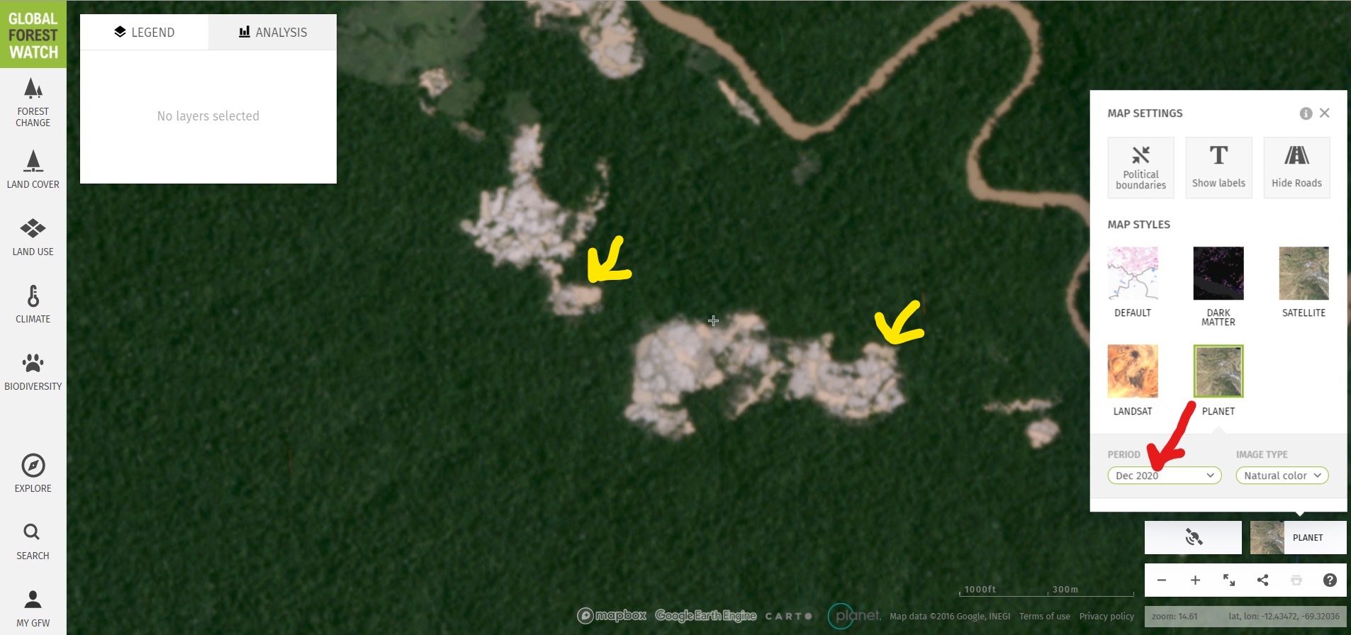
Image 8. Monthly Planet basemap for October 2020 in Pariamanu.
Ecuadorian Amazon
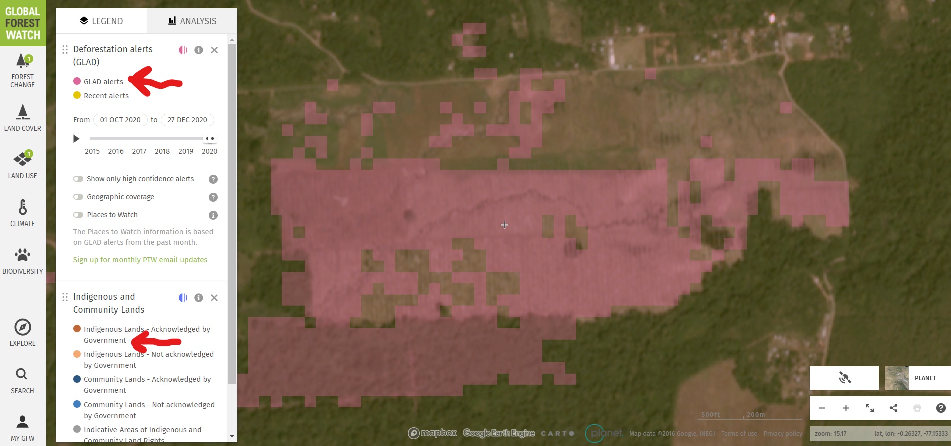
Image 9. Forest loss alerts in the Ecuadorian Amazon.
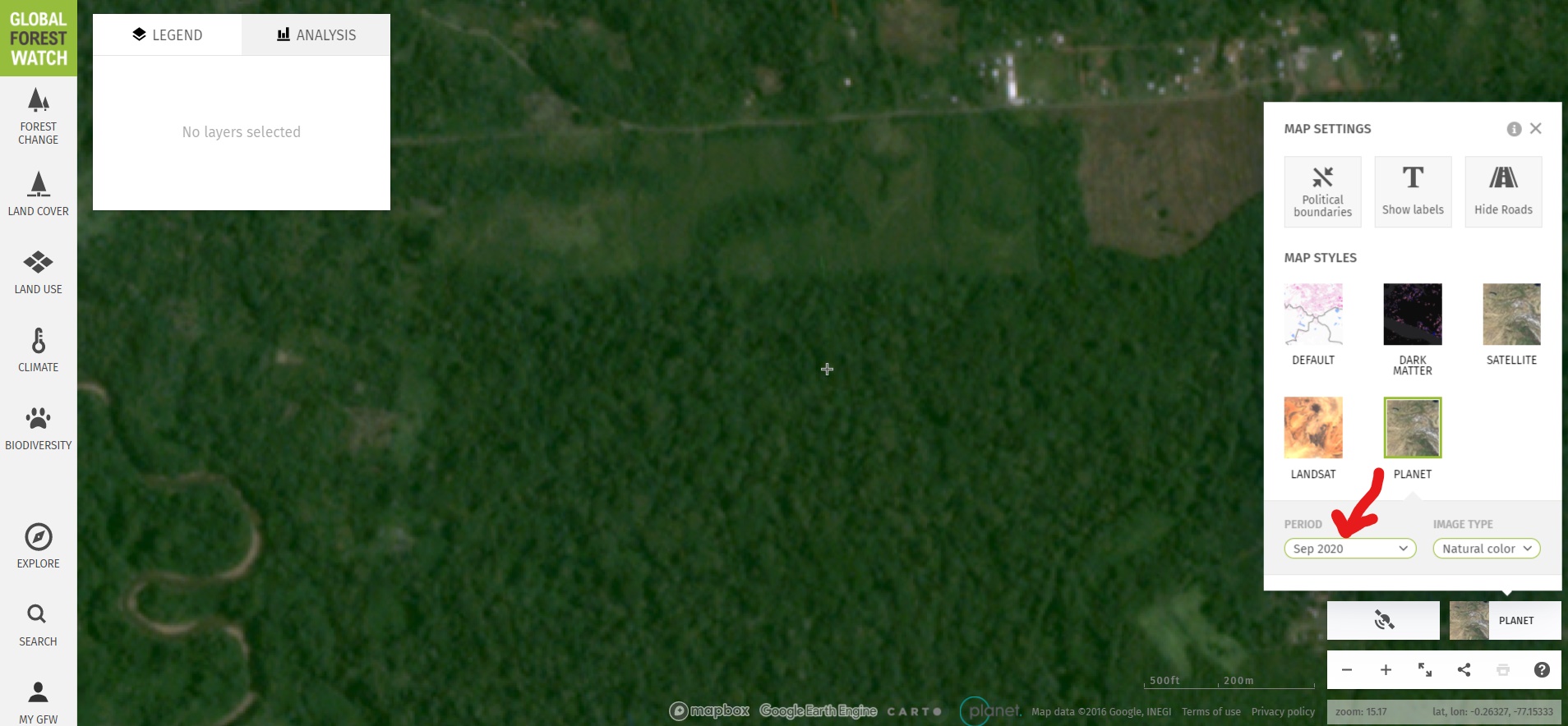
Image 10. Monthly Planet basemap for September 2020 in Ecuadorian Amazon.
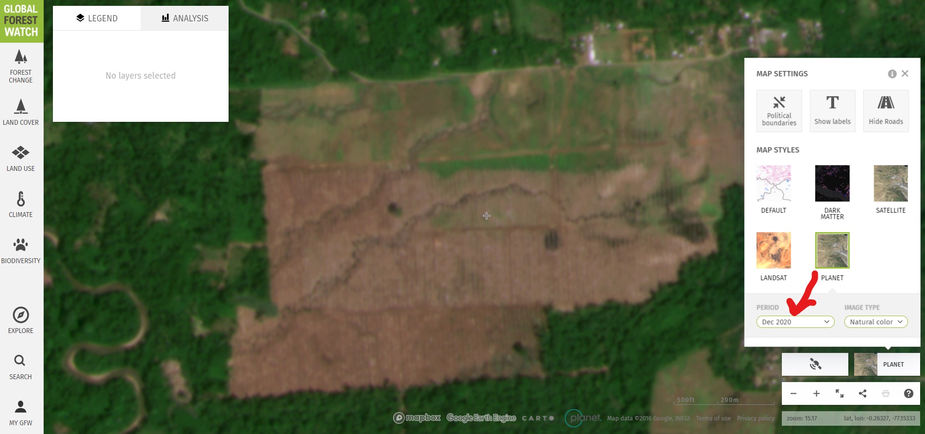
Image 11. Monthly Planet basemap for December 2020 in Ecuadorian Amazon.
Summary
*Notes
Acknowledgements
We thank M. Cohen (ACA), M. Weisse (WRI/GFW), E. Ortiz (AAF) and G. Palacios for their helpful comments on this report.
This work was supported by NORAD (Norwegian Agency for Development Cooperation).
![]()
Citation