MAAP #166: Mennonites have deforested 4,800 hectares (11,900 acres) in the Peruvian Amazon


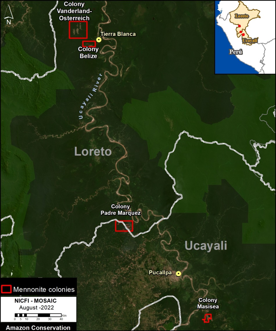
Base Map. Mennonite colonies in the Peruvian Amazon. Data: ACA/MAAP.
Since 2017, the Mennonites have arrived in the Peruvian Amazon and created 5 new colonies.
Here, we show that these colonies have caused the deforestation of more than 4,800 hectares (11,860 acres) of tropical forest, including 650 hectares (1,600 acres) in 2022.
The Base Map shows the current situation regarding the Mennonites in Peru. Note that the 5 colonies are indicated in red.
The Padre Marquez colony, located on both sides of the border between the regions of Ucayali and Loreto, has caused the deforestation of 976 hectares (2,412 acres). It is the newest colony (and represents the most urgent current situation), created in 2021 and with a great expansion in the current year 2022.
The Vanderland, Osterreich and Belize colonies, located near the town of Tierra Blanca (Loreto region), have caused the deforestation of 2,884 hectares (7,126 acres) since 2017. These colonies are also expanding in 2022.
The Masisea colony, located south of the city of Pucallpa (Ucayali region), has caused the deforestation of 960 hectares (2,372 acres) since 2017.
In total, we have documented the deforestation of 4,819 hectares (11,908 acres) in the five new Mennonite colonies in the Peruvian Amazon.
Below, we detail the deforestation history in each colony since 2017, with an emphasis on the most recent loss in 2022.
Deforestation in Mennonite Colonies (Peruvian Amazon)
Padre Marquez Colony
This colony is located on both sides of the border between the departments of Ucayali and Loreto, and has received its name since it originated in the district of Padre Marquez (Loreto). It is the newest colony, created in 2021 with the deforestation of 466 hectares (1,150 acres). This colony had a large expansion in 2022 (perhaps forming a new colony?), with additional deforestation of 491 hectares (1,213 acres). In total, we documented the deforestation of 976 hectares (2,412 acres) in the Padre Marquez colony, between the two years 2021 and 2022 (see yellow and red, respectively, in the image below). It should be emphasized that we estimate the additional degradation of 1,600 hectares (3,954 acrres) by fires that have escaped from the Mennonite plantations into the surrounding forests.
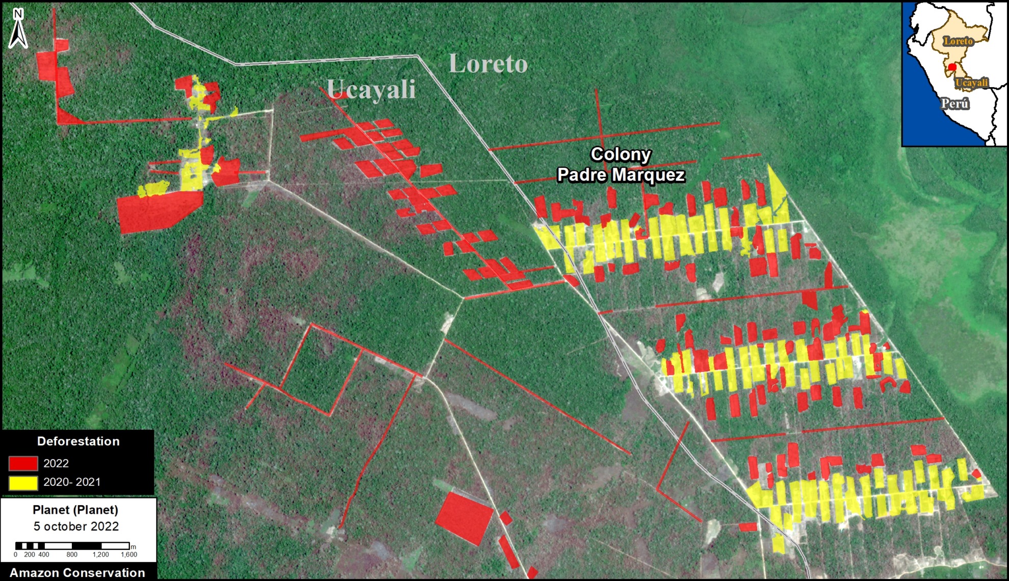
Deforestation in the Padre Marquez Mennonite colony. Data: ACA/MAAP, Planet.
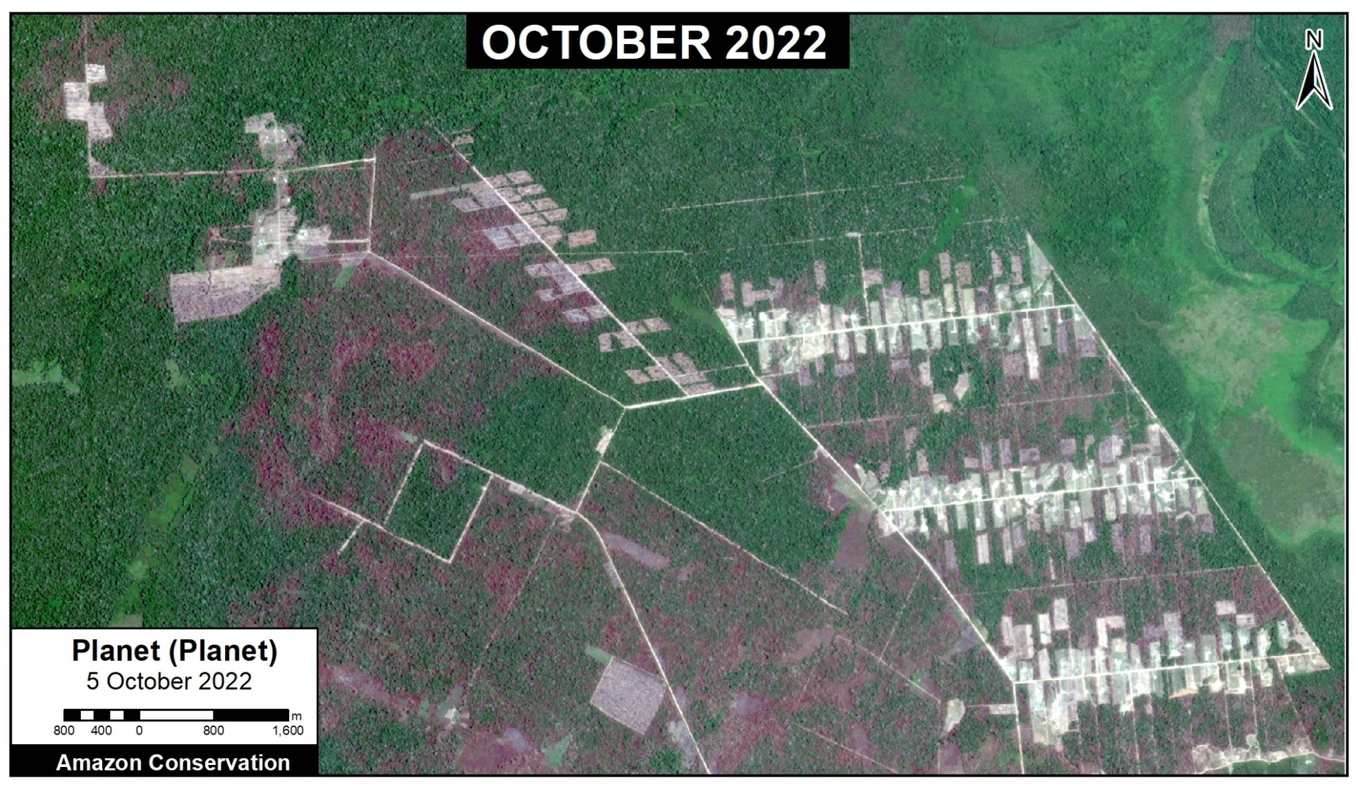
Recent image of deforestation in the Padre Marquez Mennonite colony. Data: Planet.
Vanderland & Osterreich Colonies
These two colonies are located near the town of Tierra Blanca, in the Loreto region. Deforestation was highest between the years 2017 and 2020, with the loss of 2,300 hectares (5,683 acres) (see yellow in the image, below). In 2022, we have detected the new deforestation of 71 hectares (175 acres) (see red).
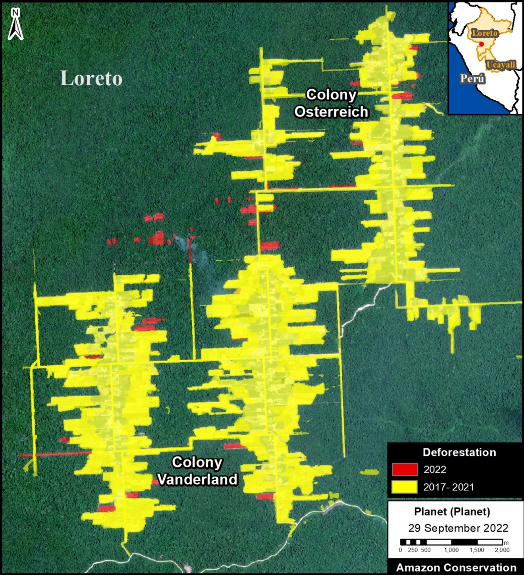
Deforestation in the Vanderland & Osterreich Mennonite colonies. Data: ACA/MAAP, Planet.

Recent image of deforestation in the Vanderland & Osterreich Mennonite colonies. Data: Planet.
Belize Colony
This colony is also located near the town of Tierra Blanca (Loreto region) and also registered the highest deforestation between 2017 and 2020, with the loss of 438 hectares (1,082 acres). In 2022, we have detected a new deforestation of 74 hectares (182 acres). Note that this most recent 2022 deforestation is expanding deeper into the surrounding forest.
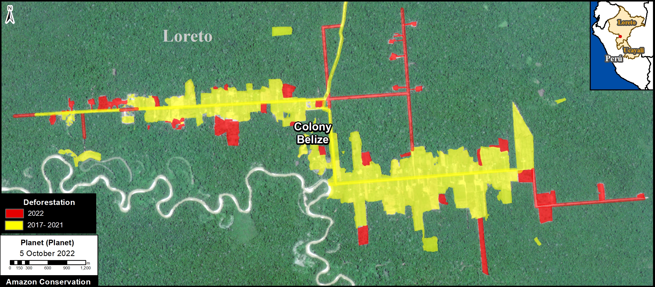
Deforestation in the Belize Mennonite colony. Data: ACA/MAAP, Planet.
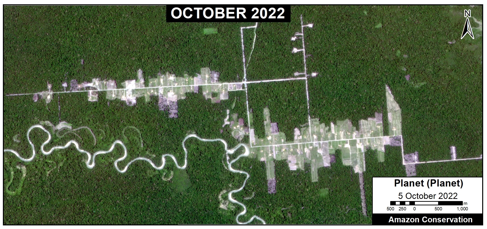
Recent image of deforestation in the Belize Mennonite colony. Data: Planet.
Masisea Colony
Esta colonia se ubica en la región Ucayali, y es la única que se ubica al sur de la ciudad de Pucallpa. La deforestación fue más alta entre los años 2017 y 2019, con la pérdida de 944 hectáreas. Al este, hubo una expansión en el 2021 de 47 hectáreas adicionales. No hemos detectado expansión notable en el 2022.
This colony is located in the Ucayali region, and is the only one located south of the city of Pucallpa. Deforestation was highest between 2017 and 2019, with the loss of 944 hectares (2,332 acres). To the east, there was an expansion in 2021 of an additional 47 hectares (117 acres). We have not detected notable expansion in 2022.
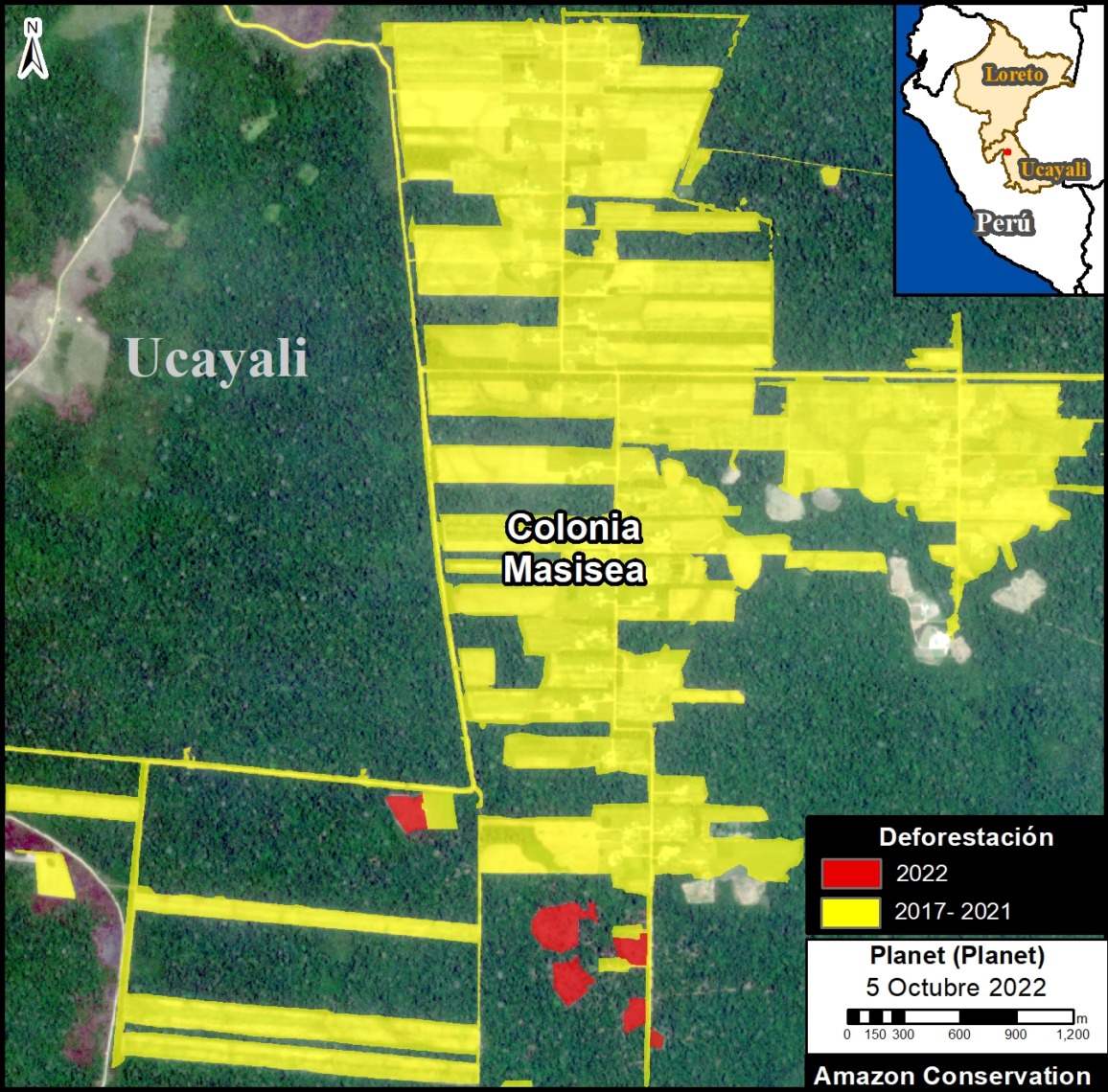
Deforestation in the Masisea Mennonite colony. Data: ACA/MAAP, Planet.
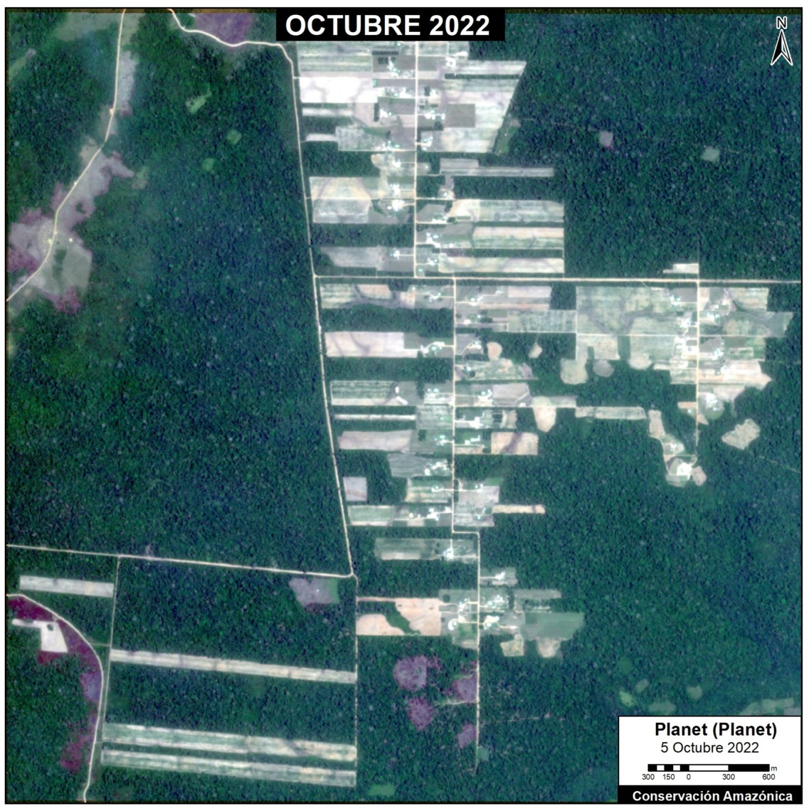
Recent image of deforestation in the Masisea Mennonite colony. Data: Planet.
Citation
Finer M, Ariñez A (2022) Mennonites have deforested 4,800 hectares (11,900 acres) in the Peruvian Amazon. MAAP: 166.
Download PDF of this article