MAAP #173: Rapid Increase of Mining Deforestation in Yapacana National Park (Venezuelan Amazon)


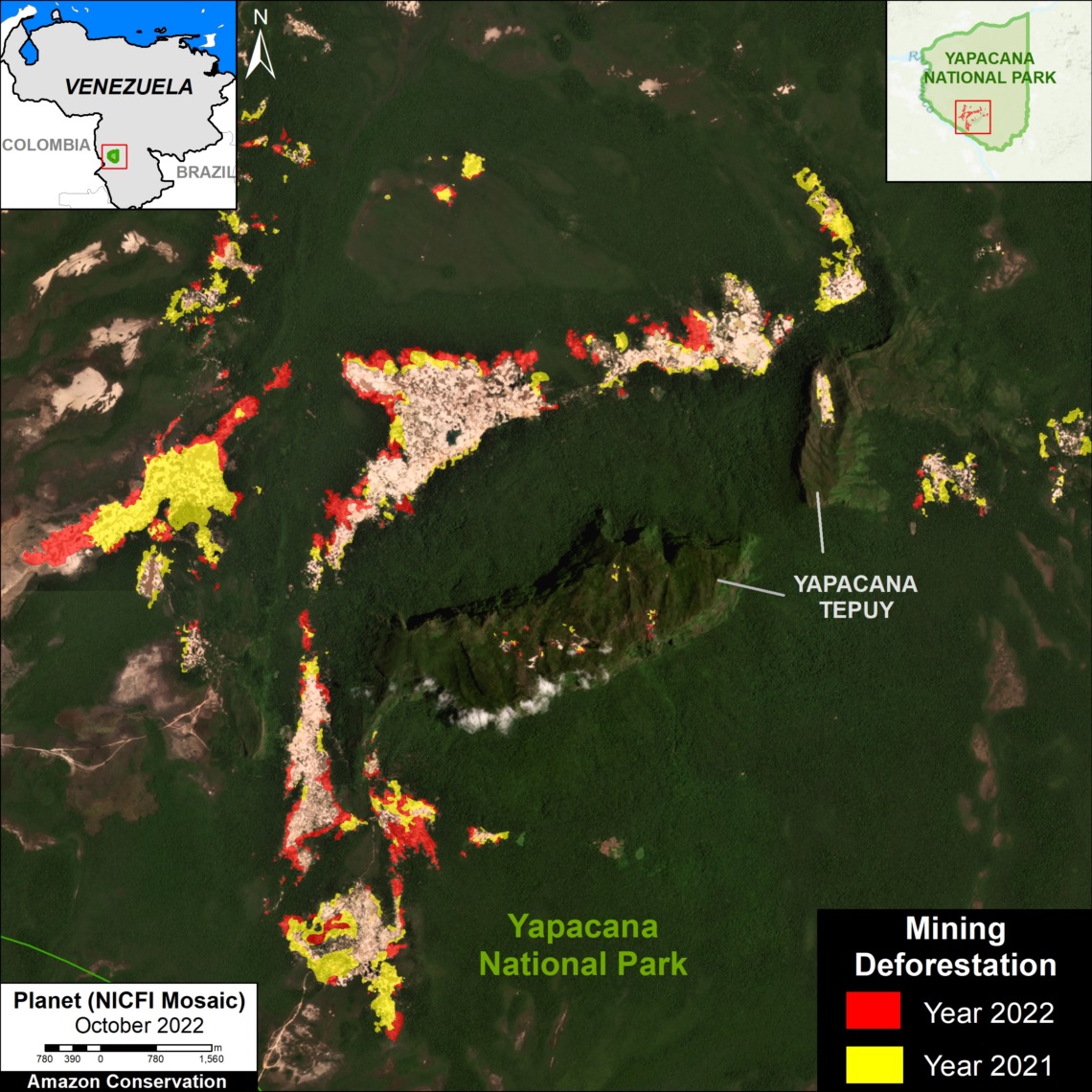
Base Map. Recent (2021-22) mining deforestation in Yapacana National Park, Venezuelan Amazon. Data: ACA/MAAP, Planet, NICFI.
We continue our series on the Venezuelan Amazon (see MAAP #155), with a special focus on the key protected area of Yapacana National Park.
In recent reports, we showed that Yapacana is currently experiencing intense illegal mining activity with likely thousands of miners (see MAAP #156), including on top of the sacred Yapacana Tepui (see MAAP #169).
Here, we focus on the most active mining zone, located in the southwestern part of the park surrounding the tepui, where mining deforestation has escalated rapidly over the past two years.
We found the new deforestation of over 750 hectares (1,870 acres) within this sector of Yapacana National Park between 2021 and 2022.
The Base Map illustrates this result, with red and yellow showing 2022 and 2021 deforestation, respectively.
Note that some of the recent deforestation (6 hectares) has occurred on top of the tepui.
Below, we zoom in and show this recent deforestation with high-resolution satellite imagery.
Deforestation 2021-22 in Yapacana National Park
Figure 1 shows the deforestation of 757 hectares between December 2020 (left panel) and October 2022 (right panel) in the southern part of Yapacana National Park surrounding Yapacana Tepui. The arrows point to the major zones before (green) and after (orange) deforestation. The Letters A-D correspond the four zooms below.
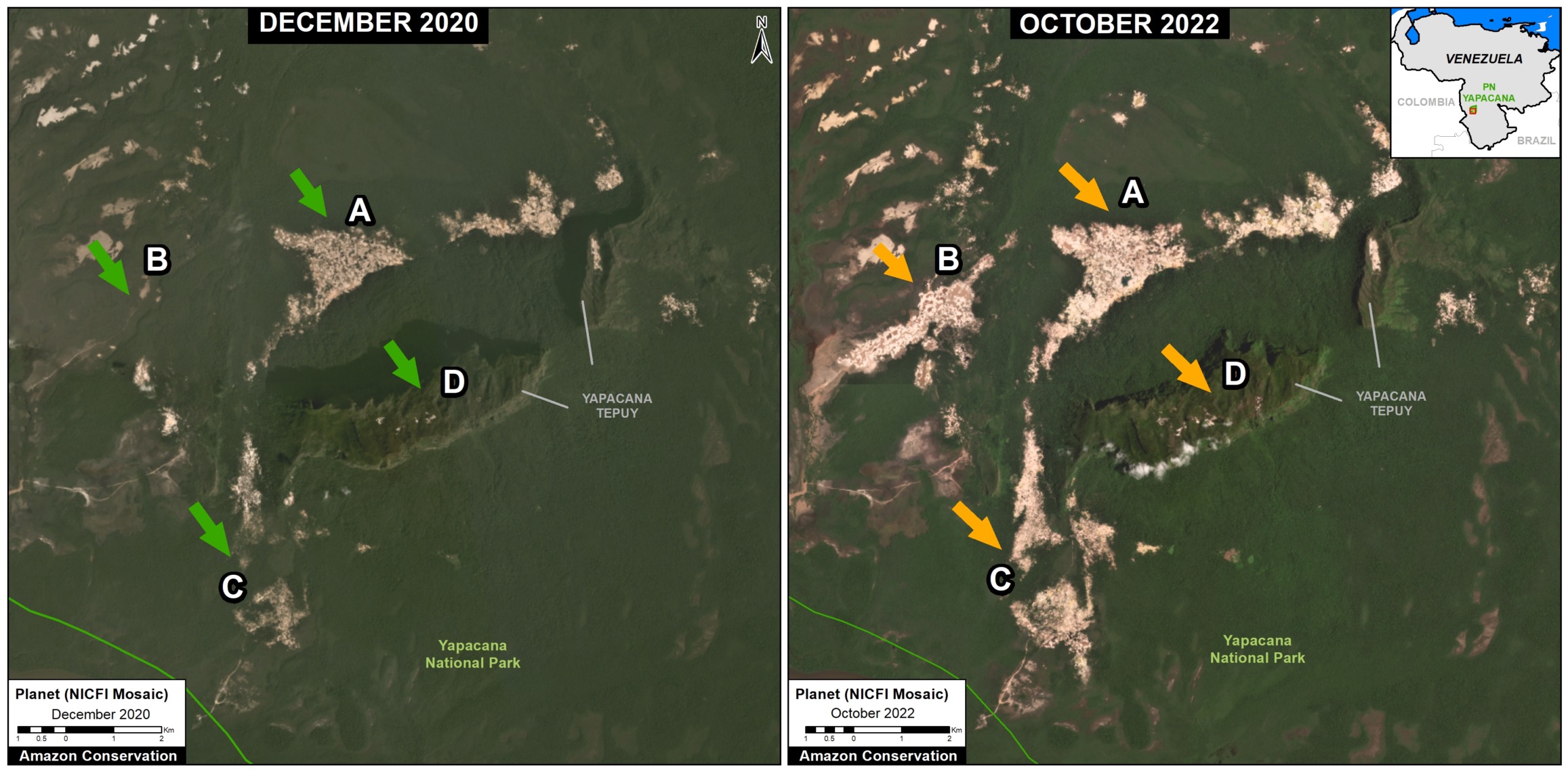
Figure 1. Recent deforestation in Yapacana National Park. The arrows point to the major zones before (green) and after (orange) deforestation. The Letters A-D correspond the four zooms below. Data: ACA/MAAP, Planet, NICFI.
Zoom A
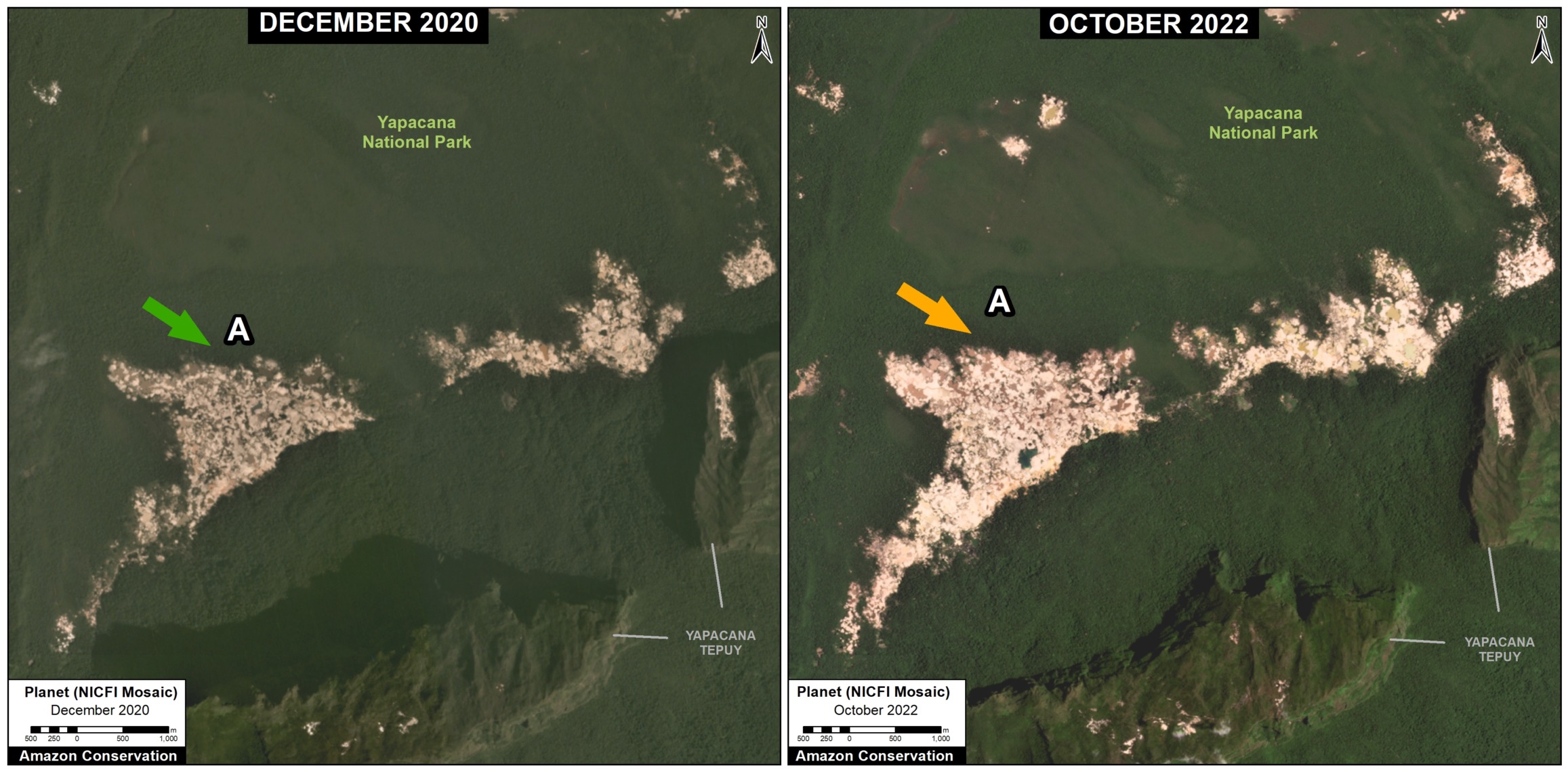
Zoom A. Data: ACA/MAAP, Planet, NICFI
Zoom B
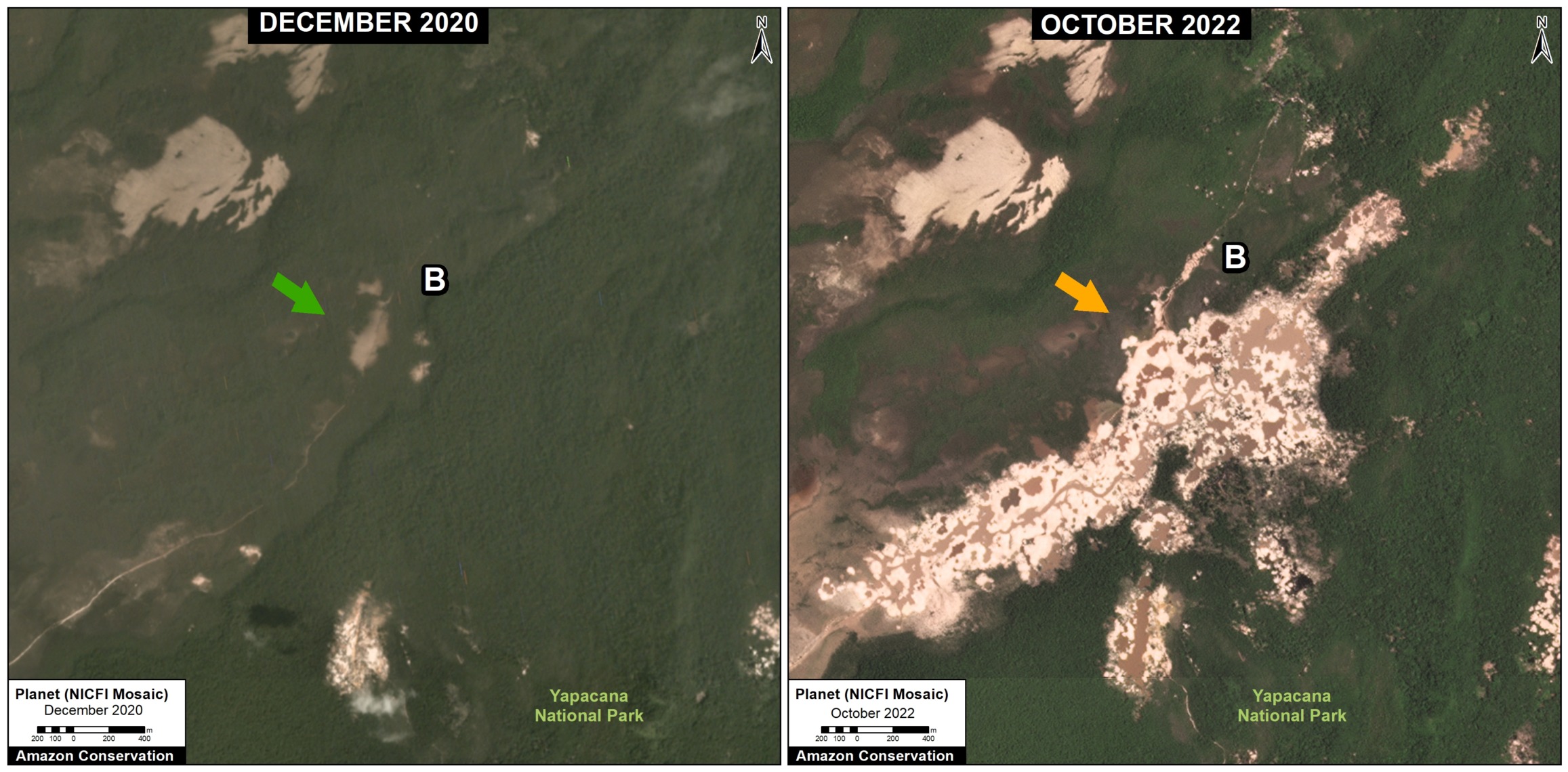
Zoom B. Data: ACA/MAAP, Planet, NICFI
Zoom C
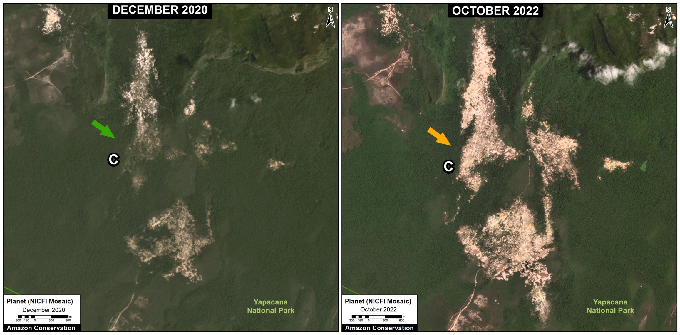
Zoom C. Data: ACA/MAAP, Planet, NICFI
Zoom D
Zoom D shows the deforestation of 4 hectares between December 2020 (left panel) and October 2022 (right panel) on top of Yapacana Tepui within the national park.
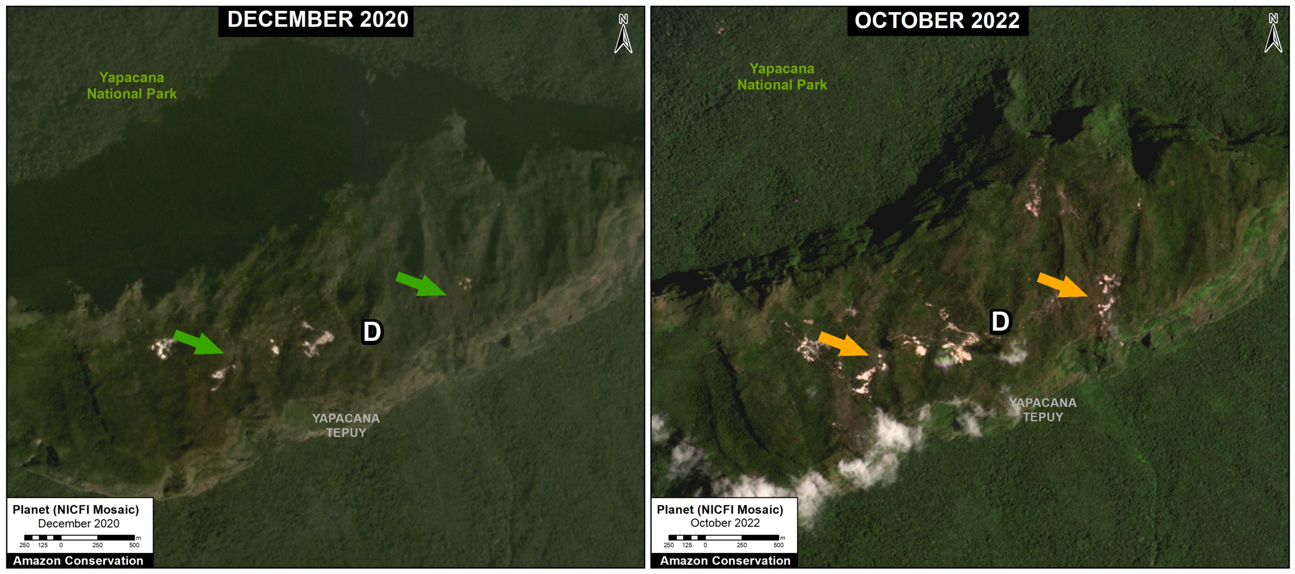
Zoom D. Data: ACA/MAAP, Planet, NICFI
Accumulated Deforestation
We estimate the accumulated mining deforestation of 1,537 hectares within this southwestern sector of Yapacana National Park. Thus, nearly half (49%) has occurred most recently in 2021-22.
Of the total accumulated deforestation, 17 hectares has occurred on top of the sacred tepui. Over a third (35%) has has occurred most recently in 2021-22.
Acknowledgements
We thank SOS Orinoco for helpful comments on this report.
Citation
Finer M, Ariñez A (2023) Rapid Increase of Mining Deforestation in Yapacana National Park (Venezuelan Amazon). MAAP: 173.
Download PDF of this article